
Recently I experienced what has become a rare occurrence. A gathering where you interact with another human being that’s not through a computer screen. You sit down, share a meal and a beverage, and have a leisurely conversation. That’s what is natural for a social species like ours. You know, it’s that thing we used to do before we automatically calculated 2 meters space between ourselves and the next person. Continuously assessing the risk level of the nearest person to us and when the hazard sign went off in your mind, taking that cautionary step or two back. I know I am not the only one. Although still strange, it was wonderful to interact with other people in a meandering conversation that had no real aim except to enjoy time with one another. As our conversation meandered, we got to the topic of generational differences and particularly how changes in education standards changes the way people see the world. We landed on the perplexing notion that as far as we could tell geography is no longer taught in schools, at least in U.S. schools. A concept that is incomprehensible to me — the daughter of a cartographer. My childhood was full of maps, atlases and random lengthy conversations on geography. Because of this I am aware my common knowledge of geography is greater than most, and I keep that in mind when speaking to people. However, I still expect a basic understanding of geography. For instance, understanding the differences between what cities, countries, and continents are; and that Africa is not a country. In our conversation we each recounted too many experiences with someone at least 12 years our juniors that left us with the thought – how have you not learned this yet?
Then we arrived on encountering younger people who have been taught there are 6 continents instead of 7. Now, if the argument had been to count Eurasia as one continent, I would have accepted that. In some places in the world Eurasia is accepted instead of Europe and Asia. But in this case Europe and Asia are counted separately and the argument was made that North and South America should be one continent because they are connected. Which I retorted with – well by that logic then we should only count 4 continents since Europe, Asia and Africa are connected – maybe we can call Eurasica or maybe Afreusia? That would leave the Americas, Antarctica, Australia, and Afreusia. But then if the logic is that Africa and Asia are not connected because of the Suez Canal then again by that same logic North and South America are also separated by the Panama Canal and therefore 2 continents not 1. My point being the logic didn’t hold either way. And while the conversation devolved into more hilarious tangents the con-census was, what do they teach kids these days? Followed by an automatic… Ugh! Did we just say that? Have we now turned into crotchety people?
Only later did I take stock of the conversation and sat with the question of continents. Was I being too close minded? Unwilling to accept a new concept or understanding. Has there been a revision to how a term is defined, and I was unaware? Did I owe an apology for being dismissive or was it really a lack of education for younger generations? So, I took a dive into the accepted consensus on continents. The consensus today by credible sources such as the National Geographic Society and Association of American Geographers being unchanged, that there are 7 or 6 if Europe and Asia are accepted as Eurasia. Which means much to my dismay the controversy of continents is due to a lack of education or in some cases doling out of opinion and not the accepted accredited terms.
I am not saying that there isn’t merit in arguing for a reclassification of what makes a continent. However, we cannot apply different criteria to define the same thing. We cannot say these are the same because they are connected but those aren’t even if they meet the same criteria. The reality is any which way you slice it, the notion of continents can be a bit of a quagmire. But we should use the accepted ideas of the accredited sources. To the people who dedicate their careers to understanding a subject matter. If not, how can we find common ground and speak without misunderstandings without the same fundamental understanding.
At its etymological roots, geography is simply the description of (graphia) the earth (geo). But there are so many ways to describe the earth not just the rocks and waters that make up its physical attributes. We can describe it by its biome, its climate, its people and its many cultures, languages, political zones, etc. How the intersection between them have influence each other and cause the migration of peoples and animals; developed cultures, societies, and borders. By its nature geography is not only interdisciplinary but consequential. How can we solve today’s challenges when we neglect geography and become geographically illiterate? That has been the grade given to 70% students in the U.S. in the 21st century by four associations that represent not only the profession but advocate for the education of geography. These include National Geographic Society, Association of American Geographers, National Council for Geographic Education, American Geographical Society. What is geographically illiterate? It means being unable to understand the basic concepts of geography and to think critically between how physical and human environments intersect.
In a modern society that is globally interdependent we cannot be dismissive of geography. Geography is not just about doling out memorized facts. It is not about knowing that the Nile is the longest river but understanding that it is a vital source for life in eleven countries in Northeast Africa and the interdependency of many groups of people that share that water source. It is about understanding that 95% of Egypt’s population live along the Nile and anything that happens to the river upstream impacts that entire country. Not only the direct impact to the people who live there, but how it can affect the country’s economy and the exports we as a global community consume that are dependent on that water source. It is about understanding how impacts on the river Nile can play a role into regional political alliances and animosities. That is thinking geographically. But how can we expect younger generations to think about these impacts if we don’t teach them where in the world the river is located, the countries in the region, and where the river originates.
How are we now or future generations to deal with the crisis of the present and immediate future if we are geography illiterate? In a time when natural resource access, environmental change, fair trade, and population displacement are top concerns for the global community we cannot be geography illiterate. We need to bring geography back to the forefront of education. So, with that I wanted to leave you this week with some geography facts.
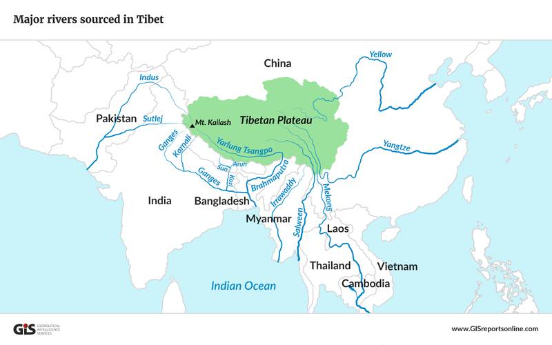
The Tibetan Plateau houses the most glacial ice outside of the poles and these glaciers are the sources that feed important rivers in Asia and on which 2 billion people depend on.
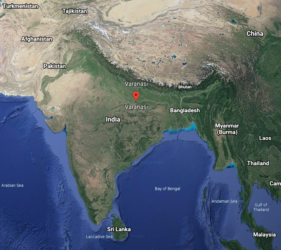
The City of Varanasi in India has been continuously inhabited for over 3000 years making one of the oldest continuously inhabited cities in the world. It is located on the river Ganges in the region of North India. Is has been a hub for philosophy and spiritual teachings since antiquity. It is a pilgrimage site for followers of Hinduism, Jainism, and Buddhism.
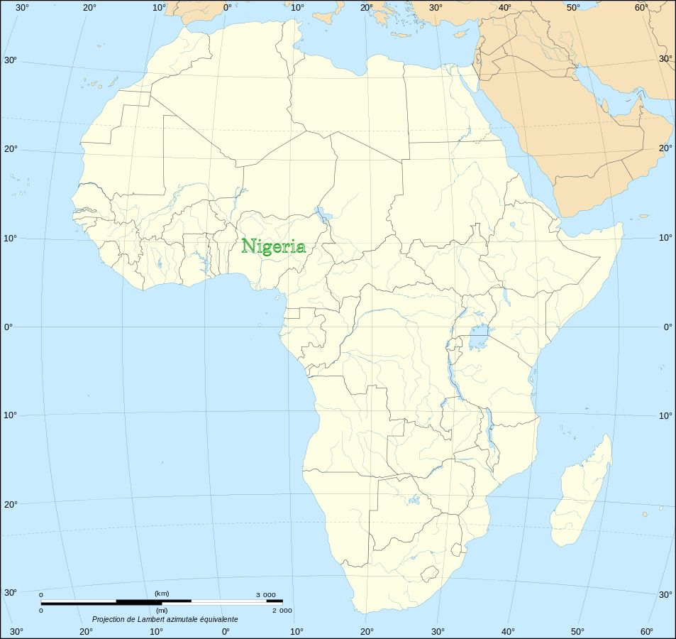
There are 54 countries on the African Continent with Nigeria being the most populous.
A linguistically rich continent with over 2000 languages but interestingly because of colonization 27 of the 54 countries speak French as either an official language or as a secondary language.
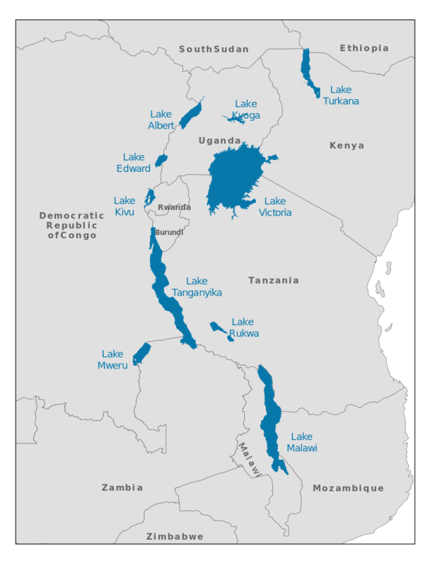
There are also Great Lakes in Africa which hold about 25% of the world’s unfrozen freshwater. The Great Lakes in North America holds 21% and Lake Baikal in Russia holds another 20%. These 3 locations hold the majority of unfrozen freshwater.

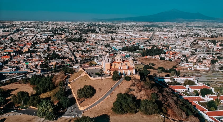
The oldest continuously inhabited city in North America is Cholula,Mexico. It has various pyramids still in existence. It is located about 78 mi (127 km) from Mexico City. The city dates to about 500 B.C.E. Let’s recognize there were multiple well establish empires and civilizations in North and South America before the arrival and conquest by Europeans.
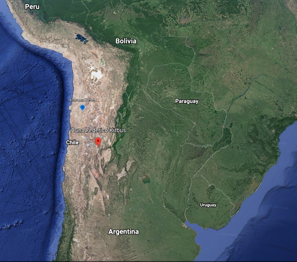
The tallest sand dune in the world, the Federico Kirbus, is located in Argentina (red marker).
The driest region on earth is the Atacama Desert in Chile with about 1mm of rain a year (blue marker).
Not what you expected, right?!
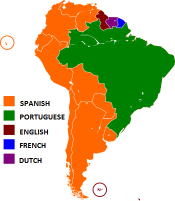
Of the 12 countries (plus 2 territories) in South America 9 countries use Spanish as their official language. Yet somehow all have a different word for a drinking straw — to be fair it’s any Spanish speaking country. There is no consensus on the term for straw. Just try asking a spanish speaker; the results are wide ranging and interesting.
